8.20.2010

sea creek falls

#20
Visited: 8.20.2010
Region: Fannin County - Coopers Creek WMA - Chattahoochee NF
Water Body: Sea Creek
Accessability: moderate (2)
Type: shelf
Primary Rock: granite
Height: 30'
Flow: normal/humming (4)
Awe Factor: boring (2)
Cavity Access: no
Companions: Martin Ade
Foot Travel: on trail/2mi
Altitude:
Grid Location: [not available]


Sea Creek Falls

[insert story here - no people, but littered with white trash & redneck residue]

Sea Creek Falls

little rock creek falls

#19
Visited: 8.20.2010
Region: Fannin County - Blue Ridge WMA - Chattahoochee NF
Water Body: Little Rock Creek
Accessability: moderate (2)
Type: cliff, block
Primary Rock: granite
Height: 50'
Flow: normal/humming (4)
Awe Factor: inspiring (4)
Cavity Access: yes
Companions: Martin Ade
Foot Travel: on trail/2mi
Altitude:
Grid Location: [not available]


Little Rock Creek Falls

[insert story here - void of people]

Little Rock Creek Falls

noontootla falls

#18
Visited: 8.14.2010 & 8.20.2010
Region: Fannin County - Ed Jenkins NRA - Blue Ridge WMA - Chattahoochee NF
Water Body: Branch on Noontootla Creek
Accessability: dangerous

Type: blanket, block, cliff
Primary Rock: granite
Height: 500'
Flow: low/babbling (3)
Awe Factor: inspiring (4)

Cavity Access: no
Companions: Matt Walker 8/14, Martin Ade 8/20

Foot Travel: off trail/.5mi
Altitude:
Grid Location: [not available]


Noontootla Falls

[insert story here - void of people]

From left to right: the view from the top, Noontootla Falls

long creek falls

x3 lower / middle / upper --- #1, 2, 3
Visited: ca. 2.06 & 8.20.10
Region: Fannin County - Appalachian Trail - Blue Ridge WMA - Chattahoochee NF
Water Body: Long Creek
Accessability: moderate (2)
Type: cliff, block
Primary Rock: granite
Height: v/20', =/20', ^/30'
Flow: high/above average (5)
Awe Factor: impressive (3)
Cavity Access: no
Companions: Thomas Swetman('06), Martin Ade ('06, '10)

Foot Travel: on trail/2mi
Altitude:
Grid location: [not available]
Upper Long Creek Falls 8.20.10

[occasional trail hippie] - These falls are where it all began during a cold and snowy camping trip at Hickory Flats Cemetary in Feburary of 2006. Myself and two buddies blindly wandered off into the forest hoping to pick up the AT. After about an hour of what seemed to be mindless walking through the snow, we came upon these falls. The winter picture below was taken during that nomadic venture. Four years later, when I initiated my cascading bucket list, I returned to the falls with one of those friends to call it my starting point and take a more usable picture for this blog (seen above). Along the way we came across a lower and middle falls on Long Creek that, as far as I know, remain unamed. I'm just going to assume they're the lower/middle Long Creek Falls. These first two falls are well worth seeing, as they are off the path and show very little foot traffic, whereas the upper most falls is well traveled. I plan on visiting this site every year with those same friends with whom I first stumbled upon this little gem just off the beaten path.
Although we first encountered Long Creek Falls starting from Hickory Flats, I'd recommend accessing the AT at the Three Forks intersection across the road from where the trail crosses Noontootla Creek. It's easily reached by car, and only about a mile hike up the trail from there.


From left to right: Upper Long Creek Falls ca. 2.06, Lower Long Creek Falls 8.20.10, Middle Long Creek Falls 8.20.10

jones creek branch falls

x2 lower / upper --- #16, 17
Visited: 8.20.10
Region: Lumpkin County - Blue Ridge WMA - Chattahoochee NF
Water Body: Branch on Jones Creek
Accessability: moderate
Type: cliff
Primary Rock: granite
Flow: high/above average
Height: v/10', ^/15'
Awe Factor: impressive
Cavity Access: no
Companions: Martin Ade
Foot Travel: on trail/.75mi
Elevation: 1875'
Grid Location: N34°36.62' W84°09.45'
Upper Jones Creek Branch Falls

[insert story - void of people]


From left to right: lower Jones Creek Branch Falls, upper Jones Creek Branch Falls (top view)

jones creek falls

x3 upper / middle / lower --- #13, 14, 15
Visited: 8.14.10 & 8.20.10
Region: Lumpkin County - Bull Mountain Area
Blue Ridge WMA - Chattahoochee NF
Water Body: Jones Creek
Accessability: moderate
Type: shelf, veil, block
Primary Rock: granite
Flow: high/above average
Height: ^/20', =/25', v/60'
Awe Factor: inspiring
Cavity Access: no
Companions: Matt Walker 8.14, Martin Ade 8.20
Foot Travel: off trail/500m
Elevation: 1800'
Grid Location: N34°36.5' W84°09.5'
Upper Jones Creek Falls

[insert story here - void of people]


From left to right: Upper Jones Creek Falls 8.20, Upper Jones Creek Falls 8.14, Middle Jones Creek Falls 8.20, Middle Jones Creek Falls 8.20

From left to right: Lower Jones Creek Falls 8.20, Lower Jones Creek Falls 8.14, Lower Jones Creek Falls 8.14

8.14.2010

clay creek falls

#12
Visited: 8.14.10
Region: Lumpkin County - Dahlonega, Ga (private property)
Water Body: Clay Creek
Accessability: easy
Type: block
Primary rock: granite
Flow: normal/humming
Height: 30'
Awe Factor: boring
Cavity Access: none
Companions: Matt Walker
Foot Travel: none/paved road
Elevation: 1260'
Grid Location: N34°32.26' W84°01.32'


Clay Creek Falls


[insert story here - people driving by]


Clay Creek Falls

cane creek falls

#11
Visited: 8.14.2010
Region: Lumpkin County - Camp Glisson, Dahlonega

Water Body: Cane Creek
Accessability: very easy
Type: block
Primary Rock: granite
Height: 50'
Flow: normal/humming
Awe Factor: impressive
Cavity Access: none
Companions: Matt Walker
Foot Travel: none/paved road
Elevation: 1220'
Grid Location: N34°33.34' W84°00.55'

Cane Creek Falls

[no people] - Cane Creek Falls is easily reached via a few minutes drive from Dahlonega. The falls are located on Camp Glisson property, so be sure to gain permission to view them. When I went in August there was no one around so we just parked by the lodge/office and walked down the street to the falls.

There's a small view platform above the falls, but it's a mush better perspective from the bottom. Cross over the bridge and walk around to the base. Again, because this is not public land, please be sure not to disturb anything in the area and refrain from swimming, fishing, etc. These falls were the first of several I visited this day, as there are many worth seeing sites in the area, and was the first true intended waterfall expidition.


From left to right: Cane Creek Falls, Box turtle found near the falls

8.07.2010

glen falls

x4 cascades / upper / middle / lower --- #7, 8, 9, 10
Visited: 8.7.10
Region: Walker County - Lookout Mountain
Water Body:
Accessability: moderate (2)
Type: funnel/bottleneck
Primary Rock: granite
Height: 25' avg.
Flow: very low/trickle (2)
Awe Factor: impressive (3)
Cavity Access: none
Companions: Rebecca Link
Foot Travel: on trail/2mi
Elevation:
Grid Location: [not available]

upper cascades at glen falls

[void of people] - Glen falls is located a short drive from Lula Falls on Lookout Mountains heading back toward Chattanooga. The parking "lot" is a little tricky to catch on the winding road down the mountain, but if you find it the falls are an fairly easy 1 mile walk from the road. I visited these falls the same day as I went to Lula Falls because they are so close to each other. Although Lula Falls is much bigger, Glen Falls are unique, as they are hidden in the woods on the side of the mountain, and literally tumble down the slope through a beautiful step pattern cascade and into several interesting falls that are worth the trip...flowing or not. They were practically dry when I visited, but the rock formations alone were stunning enough to make me want to return to this site...hopefully with more water next time.

I would definitely recommend spending a little time at Glen Falls admiring the surrounding beauty. The trail will put out on the bridge at the lower falls. Cross the bridge and follow the trail up the left side of the creek, passing the middle and upper falls, to the upper cascades. Hang out there for a bit, meditate, drink a beer, get naked, or whatever floats your boat in the woods. Just don't wear a lucha libre mask and hang off the bridge. You'll never look as cool as me when I did it.


From left to right: upper glen falls, middle glen falls, lower glen falls, bridge at lower glen falls.

lula falls

x2 upper / lower --- #5, 6
Visited: 5.09 & 8.7.10
Region: Walker County - Lula lake Land Trust - Lookout Mountain
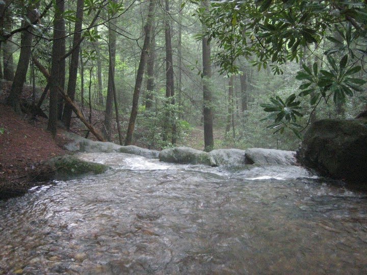
Water Body: Lake Lula
Accessibility: easy
(1)
Type: ^/bottleneck, v/overhang
Primary Rock: granite
Height: ^/20', v/300'
Flow: normal/humming (4)
Awe Factor: amazing (5)
Cavity Access: yes
Companions: Rebecca Link (5/10, 8/10), Melissa Link (8/10), Charles Clark (8/10)
Foot Travel: gravel road/2mi
Elevation:
Grid Location: [upper] N34°55.96' W85°22.34'


lower lula falls

[crawling with foreingers, family reunions, screaming children, mouthy teenagers, and ignorant dipshits with no regard for the natural environment]
And so it begins...
The falls at Lula Lake are a little known wonder tucked away in Georgia's Northwestern corner. Located on Lookout Mountain near Chattanooga, TN, The Lula Lake Land Trust is only open to the public on the first Saturday of every month. There is ample parking followed by an easy 1 mile walk to the upper and lower falls. Unfortunately there is no swimming or wading in the small Lula Lake or in the pool below the big lower falls.

My younger sister in Chattanooga first brought me to these falls in May, 2010. This initial visit to Lula Lake was inspiring enough to make me want to return, which I did a few months later with both sisters and brother-in-law. On the second trip I walked through the stream from the upper falls to the lower falls. The view from the top of the 300 foot lower falls is both inspiring and terrifying. If you're skittish of heights or the slightest bit clumsy, I wouldn't recommend getting too close to the edge. As you can see by the pictures below, I'm just an idiot...but I had to know what it would feel like.

Seeing the lower Lula Falls sparked me to want to see all the waterfalls of North Georgia. The following week I began doing online research and have since plotted over 130 falls throughout the N Ga. counties. I will return to Lula Falls at the end of this journey to give back the small stone I took from there at my first trip which I have carried with me to every falls I've visited since.


From left to right: lower lula falls 5.10, lower lula falls 8.7.10, upper lula falls 5.10, lower lula falls 8.7.10